X
The Lab gathers and analyzes research papers and methodologies related to our four sectors covering areas such as land use, soil quality, and weather patterns, with focus on the Gambia.
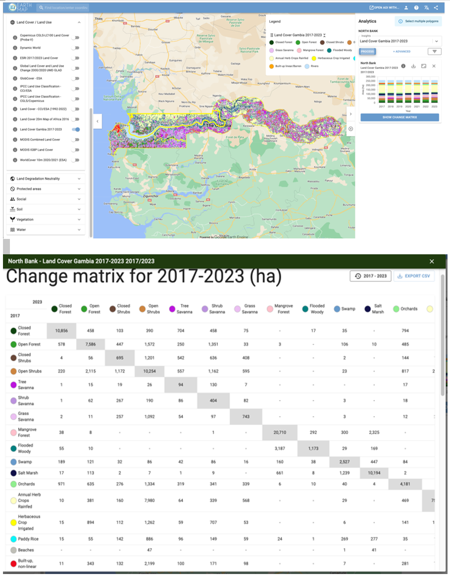
The layers produced using the selected methodologies are transformed into indicators in Google Earth Engine, allowing users to easily visualize and report on them.
The portal's thematic groups align with the ROOTS sectors:
1) Rice, 2) Gardens, 3) Mangroves, and 4) Forestry.
Each sector is represented through specific data layers, allowing users to analyse and visualize critical information tailored to their needs.
Integrate geospatial information for improved agricultural planning and monitoring in the Gambia.